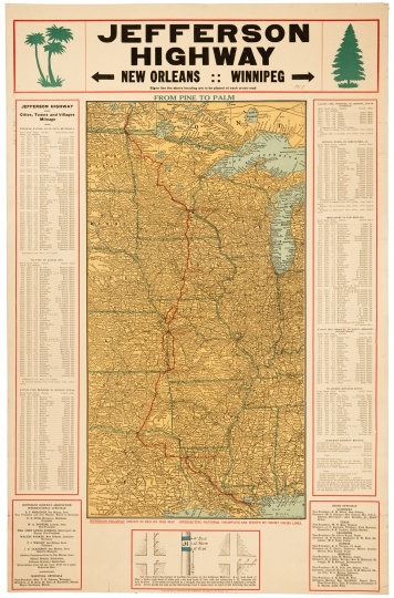
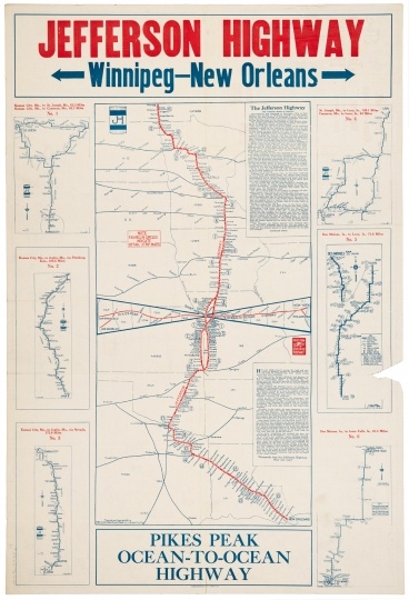
Jefferson Highway

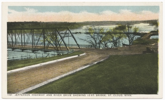
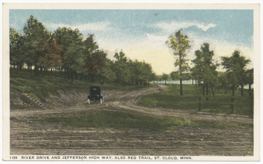
Colorized postcard featuring a view of Jefferson Highway and River Drive in St. Cloud, with the Tenth Street bridge in the center left, ca. 1917.
Bibliography
Henry Jr., Lyell D. The Jefferson Highway: Blazing the Way from Winnipeg to New Orleans. Iowa City: University of Iowa Press, 2016.
——— . “Following in the Lincoln’s Wake: The Jefferson Highway.” Lincoln Highway Forum 15, no. 4 (Summer 2008): 34–46.
Jefferson Transportation Company records, 1883–1996 (bulk 1913–1996)
Manuscript Collection, Minnesota Historical Society, St. Paul
http://www2.mnhs.org/library/findaids/00474.xml
Description: Records of a Minneapolis-based bus company that was also involved in retail and hotel projects in Minneapolis and Saint Paul. Includes business records of subsidiary, related, and acquired bus companies, and personal and business papers of long-time company president Edgar F. Zelle and other members of the Zelle family.
Sommer, Barbara W. Hard Work and a Good Deal: The Civilian Conservation Corps in Minnesota. St. Paul: Minnesota Historical Society Press, 2008.
“Story of the Minnesota Contest: Central Route Officially Adopted, St. Paul to Winnipeg.” Jefferson Highway Declaration 1, no. 7 (August 1916): 7–8.
Walsh, Margaret. “Minnesota’s ‘Mr. Bus’: Edgar F. Zelle and the Jefferson Highway Transportation Company.” Minnesota History 52, no. 8 (Winter 1991): 307–322.
http://collections.mnhs.org/MNHistoryMagazine/articles/52/v52i08p307-322.pdf
Weingroff, Richard F. “From Names to Numbers: The Origins of the U.S. Numbered Highway System.” AASHTO Quarterly (Spring 1997).
https://www.fhwa.dot.gov/infrastructure/numbers.cfm
Related Images


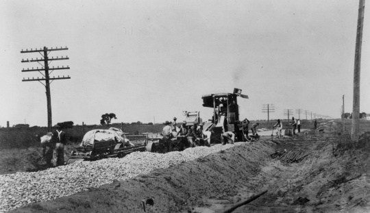
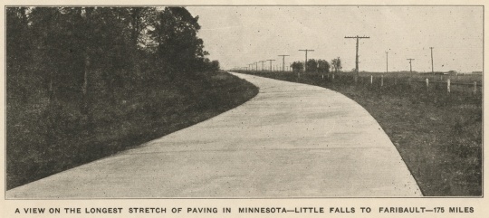
A section of the Jefferson Highway in Little Falls, photographed in November of 1922. At the time, the section of highway—175 miles—was the longest stretch of paved road in Minnesota. Cropped from a “Little Falls Paving Celebration” newsletter in the Mathias N. Koll papers, Manuscripts Collection, Minnesota Historical Society, St. Paul.


Chronology
1915
1916
1917
1917
1918
1920
1922
1930
1941
2011
Bibliography
Henry Jr., Lyell D. The Jefferson Highway: Blazing the Way from Winnipeg to New Orleans. Iowa City: University of Iowa Press, 2016.
——— . “Following in the Lincoln’s Wake: The Jefferson Highway.” Lincoln Highway Forum 15, no. 4 (Summer 2008): 34–46.
Jefferson Transportation Company records, 1883–1996 (bulk 1913–1996)
Manuscript Collection, Minnesota Historical Society, St. Paul
http://www2.mnhs.org/library/findaids/00474.xml
Description: Records of a Minneapolis-based bus company that was also involved in retail and hotel projects in Minneapolis and Saint Paul. Includes business records of subsidiary, related, and acquired bus companies, and personal and business papers of long-time company president Edgar F. Zelle and other members of the Zelle family.
Sommer, Barbara W. Hard Work and a Good Deal: The Civilian Conservation Corps in Minnesota. St. Paul: Minnesota Historical Society Press, 2008.
“Story of the Minnesota Contest: Central Route Officially Adopted, St. Paul to Winnipeg.” Jefferson Highway Declaration 1, no. 7 (August 1916): 7–8.
Walsh, Margaret. “Minnesota’s ‘Mr. Bus’: Edgar F. Zelle and the Jefferson Highway Transportation Company.” Minnesota History 52, no. 8 (Winter 1991): 307–322.
http://collections.mnhs.org/MNHistoryMagazine/articles/52/v52i08p307-322.pdf
Weingroff, Richard F. “From Names to Numbers: The Origins of the U.S. Numbered Highway System.” AASHTO Quarterly (Spring 1997).
https://www.fhwa.dot.gov/infrastructure/numbers.cfm