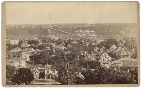
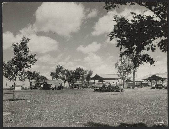
Cherokee Park, St. Paul
.jpg?width=500&height=400&name=IMG_3210(2).jpg)
Bibliography
2F G 4144 .S4G52 1929 .S2
Map Collection, Minnesota Historical Society, St. Paul
https://mnpals-mhs.primo.exlibrisgroup.com/permalink/01MNPALS_MHS/ge68j0/alma990016915870104294
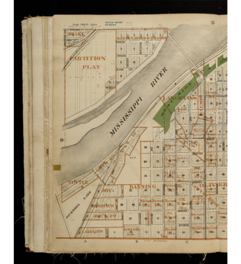
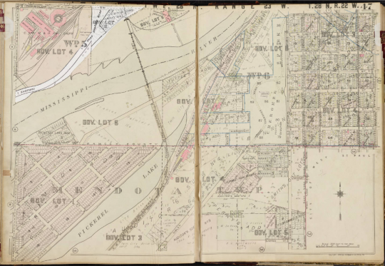
Description: Map of the St. Paul Park System, 1929.
Board of Park Commissioners of the City of Saint Paul. Annual Reports of the Board of Park Commissioners of the City of Saint Paul, 1888–1914. Available at the Minnesota Historical Society library as SB482.M62 S313.
Board of Park Commissioners of the City of Saint Paul. Park Board Records, 1887–ca. 1943
Manuscripts Collection, Minnesota Historical Society, St. Paul
Description: Meeting minutes and indexes, journals, ledgers, and park programs.
www2.mnhs.org/library/findaids/gr00518.xml
“Boulevard on the Bluff.” Broad Axe, September 9, 1897.
“Cherokee Park Ski Run Gets Icy Reception.” St. Paul Pioneer Press, July 18, 1973.
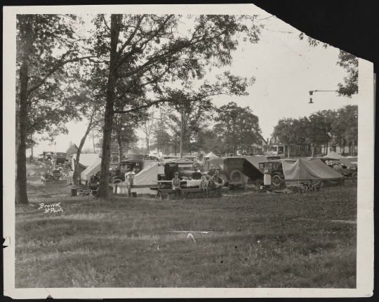
“City Tourist Camp Will Open May 15.” St. Paul Daily News, May 4, 1930.
Department of Parks, Playgrounds and Public Buildings of the City of Saint Paul. Report of the Department of Parks, Playgrounds and Public Buildings of the City of Saint Paul, 1916, 1917, 1918, 1919 & 1930. Available at the Minnesota Historical Society library as SB482.M62 S3132.
G 4144 .S4G52 1907 6F
Map Collection, Minnesota Historical Society, St. Paul
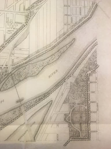
Description: Park and Parkway System, City of St. Paul, Minn, 1907.
https://mnpals-mhs.primo.exlibrisgroup.com/permalink/01MNPALS_MHS/ge68j0/alma990016079770104294
Peabody, Lloyd. History of the Parks and Public Grounds of St. Paul. St. Paul: Minnesota Historical Society, 1915. Available at the Minnesota Historical Society library as F602 .M61 v.15.
“Picnic Shelter Gift for Cherokee Park.” St Paul Dispatch, February 4, 1969.
Saint Paul Playground Committee. Annual Report of the St. Paul Playground Committee, 1904–1937. Available at the Minnesota Historical Society Library as SB482.M62 S3133.
Saint Paul Recreation Department. Annual Report of Recreational Activities, 1938–1963. St. Paul Collection, St. Paul Central Library.
"Ten Thousand Lakes Secretary Endorses Paid Tourist Camps." Sauk Centre Herald, December 16, 1926.
https://www.mnhs.org/newspapers/lccn/sn89064489/1926-12-16/ed-1/seq-2
Related Images
.jpg?width=200&height=200&name=IMG_3210(2).jpg)


.jpg?width=200&height=200&name=IMG_3359(2).jpg)
.jpg?width=200&height=200&name=IMG_3216(1).jpg)
.jpg)
.jpg)
.jpg)
Chronology
1851
1905
1906
1915
1921
1925
1931/1932
1950s
1967
1972
1973
2013
Bibliography
2F G 4144 .S4G52 1929 .S2
Map Collection, Minnesota Historical Society, St. Paul
https://mnpals-mhs.primo.exlibrisgroup.com/permalink/01MNPALS_MHS/ge68j0/alma990016915870104294
Description: Map of the St. Paul Park System, 1929.
Board of Park Commissioners of the City of Saint Paul. Annual Reports of the Board of Park Commissioners of the City of Saint Paul, 1888–1914. Available at the Minnesota Historical Society library as SB482.M62 S313.
Board of Park Commissioners of the City of Saint Paul. Park Board Records, 1887–ca. 1943
Manuscripts Collection, Minnesota Historical Society, St. Paul
Description: Meeting minutes and indexes, journals, ledgers, and park programs.
www2.mnhs.org/library/findaids/gr00518.xml
“Boulevard on the Bluff.” Broad Axe, September 9, 1897.
“Cherokee Park Ski Run Gets Icy Reception.” St. Paul Pioneer Press, July 18, 1973.
“City Tourist Camp Will Open May 15.” St. Paul Daily News, May 4, 1930.
Department of Parks, Playgrounds and Public Buildings of the City of Saint Paul. Report of the Department of Parks, Playgrounds and Public Buildings of the City of Saint Paul, 1916, 1917, 1918, 1919 & 1930. Available at the Minnesota Historical Society library as SB482.M62 S3132.
G 4144 .S4G52 1907 6F
Map Collection, Minnesota Historical Society, St. Paul
Description: Park and Parkway System, City of St. Paul, Minn, 1907.
https://mnpals-mhs.primo.exlibrisgroup.com/permalink/01MNPALS_MHS/ge68j0/alma990016079770104294
Peabody, Lloyd. History of the Parks and Public Grounds of St. Paul. St. Paul: Minnesota Historical Society, 1915. Available at the Minnesota Historical Society library as F602 .M61 v.15.
“Picnic Shelter Gift for Cherokee Park.” St Paul Dispatch, February 4, 1969.
Saint Paul Playground Committee. Annual Report of the St. Paul Playground Committee, 1904–1937. Available at the Minnesota Historical Society Library as SB482.M62 S3133.
Saint Paul Recreation Department. Annual Report of Recreational Activities, 1938–1963. St. Paul Collection, St. Paul Central Library.
"Ten Thousand Lakes Secretary Endorses Paid Tourist Camps." Sauk Centre Herald, December 16, 1926.
https://www.mnhs.org/newspapers/lccn/sn89064489/1926-12-16/ed-1/seq-2