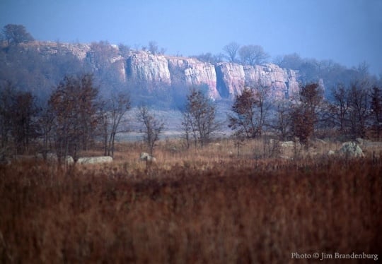
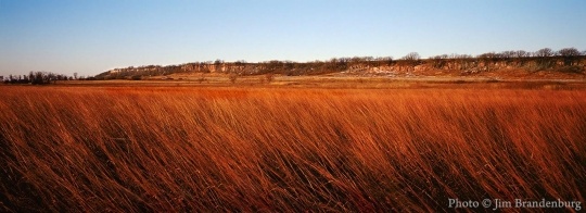
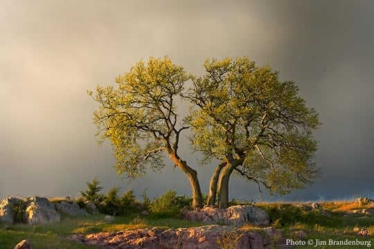
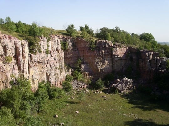
Blue Mounds State Park

Bibliography
Allen, Bill. “Bona Fide Bison.” Minnesota Conservation Volunteer no. 76 (November–December 2013): 21–31.
Barmore, Frank E. “The Blue Mounds Stone Wall: Astronomical Significance and Antiquity.” Minnesota Archaeologist 44 (Fall, Winter 1985): 41–49.
Blue Mounds State Park WPA/Rustic Style Historic Resources. Blue Mounds State Park. National Register of Historic Places Registration Form.
http://npgallery.nps.gov/nrhp/GetAsset?assetID=4b682532-8b40-4091-93b3-b98ece1c37a7
Hudson, Lew. “Blue Mounds Stone Fence.” Minnesota Archaeologist 37 (May 1978): 50–55.
Ingebretsen, Chris. Personal communication with the author, September 22, 2016.
Lothson, Gordon A. “Test Excavation at the Rock Wall Site, 21 RK 8, Blue Mounds State Park.” Minnesota Archaeologist 45 (Spring, Summer 1986): 37–47.
Meyer, Roy W. Everyone’s Country Estate: A History of Minnesota’s State Parks. St. Paul: Minnesota Historical Society Press, 1991.
Minnesota Department of Natural Resources. A Management Plan for Blue Mounds State Park, May, 1979.
https://www.leg.state.mn.us/edocs/edocs?oclcnumber=07255492
Minnesota Department of Natural Resources. Blue Mounds State Park.
http://www.dnr.state.mn.us/state_parks/blue_mounds/index.html
Minnesota Department of Natural Resources. Minneopa State Park Management Plan Amendment, Bison Reintroduction, August, 2014.
http://files.dnr.state.mn.us/input/mgmtplans/parks/minneopa_bison_amendment.pdf
Minnesota Department of Natural Resources. Blue Mounds State Park Map.
http://files.dnr.state.mn.us/maps/state_parks/spk00121.pdf
Minnesota Department of Natural Resources, Notropis tristis, Topeka Shiner.
http://www.dnr.state.mn.us/rsg/profile.html?action=elementDetail&selectedElement=AFCJB28960
Minnesota Department of Natural Resources. Tropidoclonion lineatum, Lined Snake.
http://www.dnr.state.mn.us/rsg/profile.html?action=elementDetail&selectedElement=ARADB38010
“Mound Springs State Park is Open.” Rock Country Star Herald, May 10, 1951.
Ojakangas, Richard W. Roadside Geology of Minnesota. Missoula, MT: Mountain Press Publishing Company, 2009.
Rose, Arthur P. An Illustrated History of the Counties of Rock and Pipestone Minnesota. Luverne, MN: Northern History Publishing Company, 1911.
https://archive.org/stream/illustratedhistorrpm00rose#page/236/mode/2up
175 r.6
Plat book of Rock County
Map Collection, Minnesota Historical Society, St. Paul
Description: Plat book of Rock County, Mound Township, Minnesota, 1886.
U.S. Department of the Interior. 15 Facts about our National Mammal: The American Bison.
https://www.doi.gov/blog/15-facts-about-our-national-mammal-american-bison
Related Images


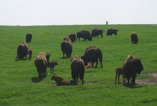
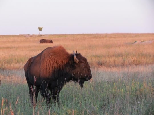
Adult bison and calves at Blue Mounds State Park
Holding Location
Articles


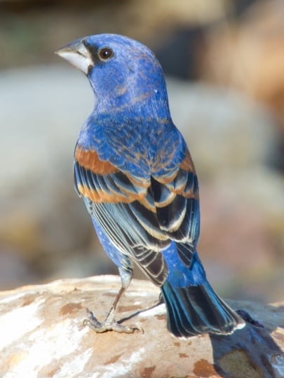
Blue grosbeak
Holding Location
Articles
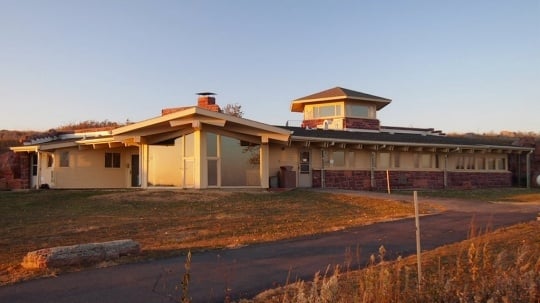
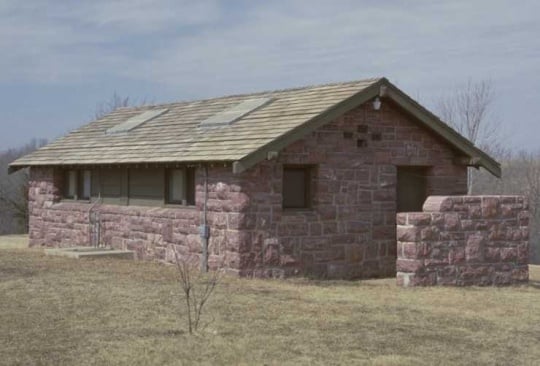
Blue Mounds State Park interpretive center
Holding Location
Articles
More Information

Chronology
1,700 million years ago
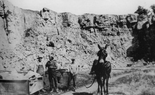
ca. 1870s
1876
1937
1938
1939
1951
1961
1976
1985
1986
1989
2014
2016
2016
Bibliography
Allen, Bill. “Bona Fide Bison.” Minnesota Conservation Volunteer no. 76 (November–December 2013): 21–31.
Barmore, Frank E. “The Blue Mounds Stone Wall: Astronomical Significance and Antiquity.” Minnesota Archaeologist 44 (Fall, Winter 1985): 41–49.
Blue Mounds State Park WPA/Rustic Style Historic Resources. Blue Mounds State Park. National Register of Historic Places Registration Form.
http://npgallery.nps.gov/nrhp/GetAsset?assetID=4b682532-8b40-4091-93b3-b98ece1c37a7
Hudson, Lew. “Blue Mounds Stone Fence.” Minnesota Archaeologist 37 (May 1978): 50–55.
Ingebretsen, Chris. Personal communication with the author, September 22, 2016.
Lothson, Gordon A. “Test Excavation at the Rock Wall Site, 21 RK 8, Blue Mounds State Park.” Minnesota Archaeologist 45 (Spring, Summer 1986): 37–47.
Meyer, Roy W. Everyone’s Country Estate: A History of Minnesota’s State Parks. St. Paul: Minnesota Historical Society Press, 1991.
Minnesota Department of Natural Resources. A Management Plan for Blue Mounds State Park, May, 1979.
https://www.leg.state.mn.us/edocs/edocs?oclcnumber=07255492
Minnesota Department of Natural Resources. Blue Mounds State Park.
http://www.dnr.state.mn.us/state_parks/blue_mounds/index.html
Minnesota Department of Natural Resources. Minneopa State Park Management Plan Amendment, Bison Reintroduction, August, 2014.
http://files.dnr.state.mn.us/input/mgmtplans/parks/minneopa_bison_amendment.pdf
Minnesota Department of Natural Resources. Blue Mounds State Park Map.
http://files.dnr.state.mn.us/maps/state_parks/spk00121.pdf
Minnesota Department of Natural Resources, Notropis tristis, Topeka Shiner.
http://www.dnr.state.mn.us/rsg/profile.html?action=elementDetail&selectedElement=AFCJB28960
Minnesota Department of Natural Resources. Tropidoclonion lineatum, Lined Snake.
http://www.dnr.state.mn.us/rsg/profile.html?action=elementDetail&selectedElement=ARADB38010
“Mound Springs State Park is Open.” Rock Country Star Herald, May 10, 1951.
Ojakangas, Richard W. Roadside Geology of Minnesota. Missoula, MT: Mountain Press Publishing Company, 2009.
Rose, Arthur P. An Illustrated History of the Counties of Rock and Pipestone Minnesota. Luverne, MN: Northern History Publishing Company, 1911.
https://archive.org/stream/illustratedhistorrpm00rose#page/236/mode/2up
175 r.6
Plat book of Rock County
Map Collection, Minnesota Historical Society, St. Paul
Description: Plat book of Rock County, Mound Township, Minnesota, 1886.
U.S. Department of the Interior. 15 Facts about our National Mammal: The American Bison.
https://www.doi.gov/blog/15-facts-about-our-national-mammal-american-bison