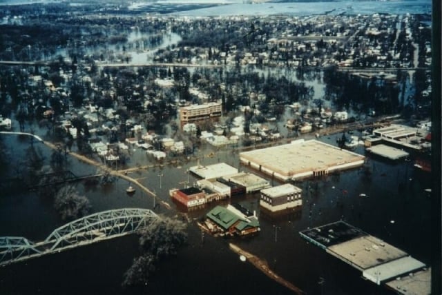
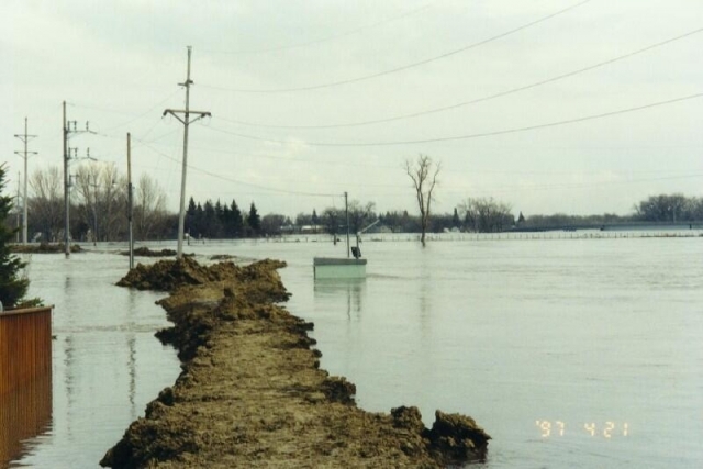
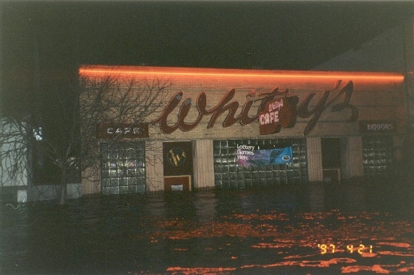
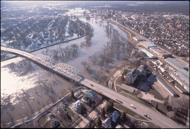
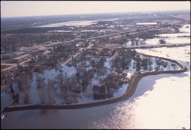
Flooding of the Red River, 1997

Bibliography
Bauer, Shannon. “District Fought Floods in Three River Basins.” Crosscurrents 30, no. 9 (October–November, 2007): 7–16. US Army Corps of Engineers.
https://usace.contentdm.oclc.org/utils/getfile/collection/p16021coll8/id/1834
City of Grand Forks. 1997 Flood Timeline.
https://www.grandforksgov.com/government/city-departments/public-information-center/1997-flood/1997-flood-timeline
“Clinton Tours Flood-Ravaged North Dakota.” CNN, April 22, 1997.
https://www.cnn.com/ALLPOLITICS/1997/04/22/earth.floods
DeLage, Jaime. “A Dark Day: Blizzard Hannah Caused a Variety of Problems.” Grand Forks Herald, April 6, 1997.
FEMA. 1997 Grand Forks Flood By the Numbers.
https://www.fema.gov/fact-sheet/1997-grand-forks-flood-numbers
Memories of 1997. The Greenway.
http://www.greenwayggf.com/1997-flood-memories.html
National Weather Service. “North Central US Flooding Red River Basin, April 1997.” https://www.weather.gov/media/publications/assessments/North_Central_US_Flooding_Red_River_Basin_April1997.pdf
NOAA. Flooding of the Red River Valley and Tributaries during April 1997. https://www.cpc.ncep.noaa.gov/products/assessments/assess_97/rriver.html
Olson, Dave. “Flood Victims Flee Ada.” Fargo Forum, April 8, 1997.
Schmickle, Sharon. “Clinton Gets His Flood Bill.” Minneapolis Star Tribune, June 13, 1997.
Shelby, Ashley. Red River Rising: The Anatomy of a Flood and the Survival of an American City. Minnesota Historical Society Press (Borealis Books), 2003.
Sip, Robert. “Past, Current Floods Reveal Red River Basin’s Needs.” Minneapolis Star Tribune, April 26, 2022.
Swanson, Ian. “One Journey Ends; Another Begins.” Grand Forks Herald, June 27, 2000.
University of Virginia. Miller Center. “April 22, 1997: Address to the people and relief workers of Grand Forks, ND.”
https://millercenter.org/the-presidency/presidential-speeches/april-22-1997-address-people-and-relief-workers-grand-forks-nd
Wagner, Cale. “Storm Stops Many in their Tracks.” Grand Forks Herald, November 18, 1996.
Welcome to the Greenway. The Greenway.
http://www.greenwayggf.com
Related Images


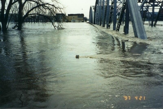
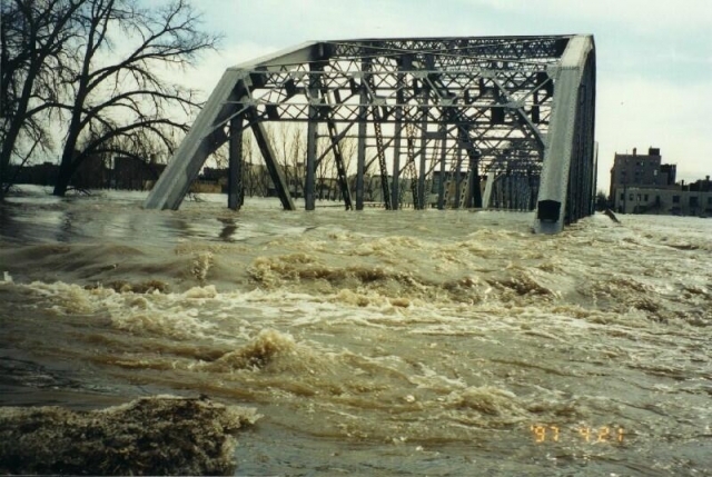
The top of a US Geological Survey staff gauge (a graduated rod against which water levels can be read) is barely visible above the water flooding Sorlie Bridge on April 21, 1997. The top of the gauge represents a water level or river stage of 54.50 feet, two feet above the 1997 East Grand Forks city levee. During the 1997 flood, the Red River crested at 54.35 feet; the National Weather Service flood stage at Grand Forks is 28.00 feet. Photo by the United States Geological Survey.


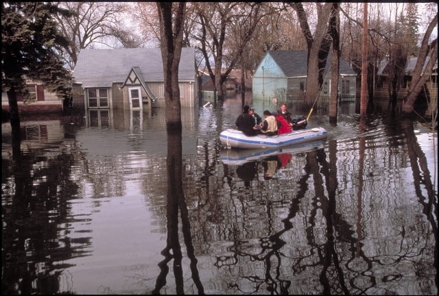
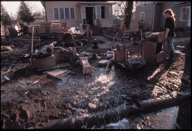
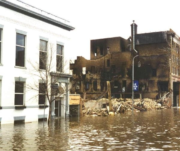
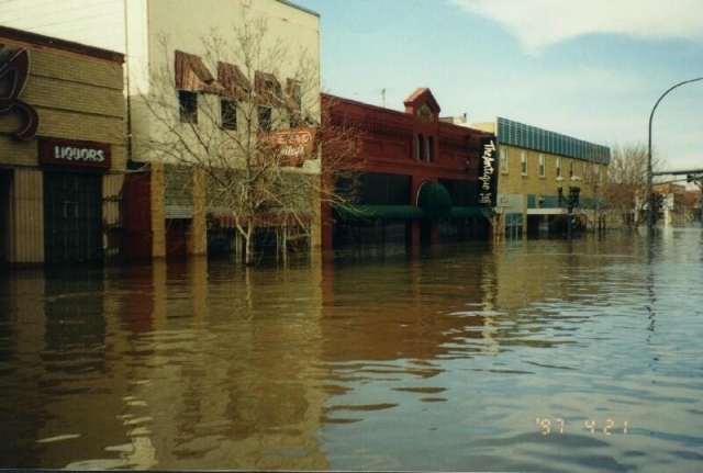
Chronology
November 17, 1996
April 4–5, 1997
April 7, 1997
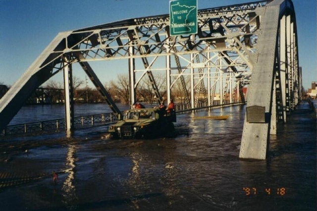
April 18, 1997
April 19, 1997
April 22, 1997
April 23, 1997
May 19, 1997
June 12, 1997
President Clinton signs into law more than $1 billion in federal aid to repair damaged infrastructure and to authorize widespread buyouts along the river. The money also funds flood-protection systems at points throughout the valley.
June 26, 2000
January 2007
Bibliography
Bauer, Shannon. “District Fought Floods in Three River Basins.” Crosscurrents 30, no. 9 (October–November, 2007): 7–16. US Army Corps of Engineers.
https://usace.contentdm.oclc.org/utils/getfile/collection/p16021coll8/id/1834
City of Grand Forks. 1997 Flood Timeline.
https://www.grandforksgov.com/government/city-departments/public-information-center/1997-flood/1997-flood-timeline
“Clinton Tours Flood-Ravaged North Dakota.” CNN, April 22, 1997.
https://www.cnn.com/ALLPOLITICS/1997/04/22/earth.floods
DeLage, Jaime. “A Dark Day: Blizzard Hannah Caused a Variety of Problems.” Grand Forks Herald, April 6, 1997.
FEMA. 1997 Grand Forks Flood By the Numbers.
https://www.fema.gov/fact-sheet/1997-grand-forks-flood-numbers
Memories of 1997. The Greenway.
http://www.greenwayggf.com/1997-flood-memories.html
National Weather Service. “North Central US Flooding Red River Basin, April 1997.” https://www.weather.gov/media/publications/assessments/North_Central_US_Flooding_Red_River_Basin_April1997.pdf
NOAA. Flooding of the Red River Valley and Tributaries during April 1997. https://www.cpc.ncep.noaa.gov/products/assessments/assess_97/rriver.html
Olson, Dave. “Flood Victims Flee Ada.” Fargo Forum, April 8, 1997.
Schmickle, Sharon. “Clinton Gets His Flood Bill.” Minneapolis Star Tribune, June 13, 1997.
Shelby, Ashley. Red River Rising: The Anatomy of a Flood and the Survival of an American City. Minnesota Historical Society Press (Borealis Books), 2003.
Sip, Robert. “Past, Current Floods Reveal Red River Basin’s Needs.” Minneapolis Star Tribune, April 26, 2022.
Swanson, Ian. “One Journey Ends; Another Begins.” Grand Forks Herald, June 27, 2000.
University of Virginia. Miller Center. “April 22, 1997: Address to the people and relief workers of Grand Forks, ND.”
https://millercenter.org/the-presidency/presidential-speeches/april-22-1997-address-people-and-relief-workers-grand-forks-nd
Wagner, Cale. “Storm Stops Many in their Tracks.” Grand Forks Herald, November 18, 1996.
Welcome to the Greenway. The Greenway.
http://www.greenwayggf.com